July 29, 2019
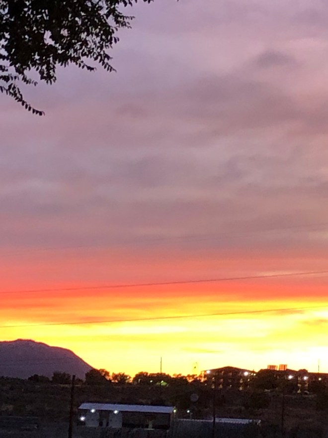
I always thought the drive down to Homer from the bluffs was breathtaking. The spit reaching out into the huge bay, the mountains, glaciers, glisten of the sea, the boats making their way… I hadn’t been to Seward though.
The drive down and around to Seward was entirely different than the Homer experience had been. To Seward we drove through a pastoral valley… I talked about it here in my last post. It was… shoot, I’ve already used the word breathtaking. This drive raises the previous one by a power 2. So, Homer = 10,
Seward – 10* with the * being a tiny 2.
After enjoying the many offerings of Seward, we climbed back to the valley and back through Anchorage (with a stop at The Moose is Loose for more cinnamon bread) (smelling the toast as Barb prepared her breakfast made me resent my gut mightly, for it’s problem with gluten!).
From Anchorage, we made our way to Palmer. Palmer is the “bread basket” of Alaska. The soil is so rich, the sun so enduring (16+ hours a day), the water so laced with glacier minerals… well, they grow the HUGEST vegetables! Like a 247# pumpkin – in the 3 months before winter sets in! Beets that are 7# and cabbage heads the size of beach balls.
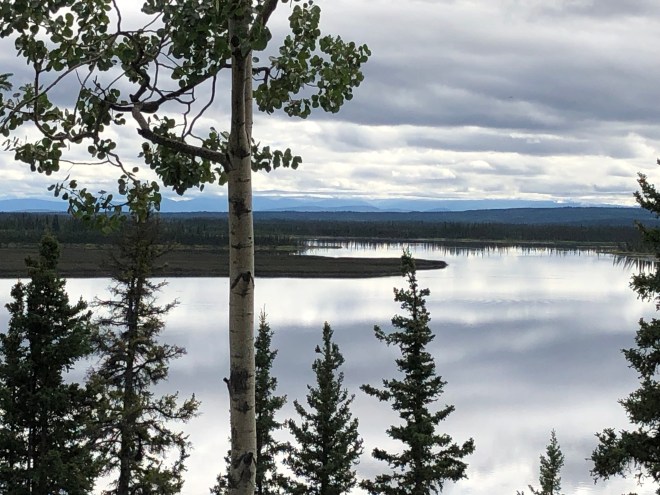
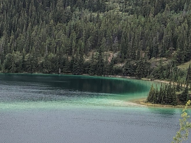
After dramatic mountains, striking lakes ponds the color of emeralds (yes, Emerald Lake was on our route) and verdigris, this valley spoke calm soothing peaceful afternoons to me.
Palmer started out a heavily forested valley. When the States were in desperate straits in the Great Depression our esteemed government decided to relocate farmers and their families to this outpost of civilization. So many people volunteered to make the journey folks had to be turned away.
When the ships and wagons brought the original families to the valley, they were not met with farmland but instead huge trees. Since they had to travel when the ice had broken up, they arrived when summer was waning. The government sent along trained engineers and proctors who held a generous bank and plenty of tools and supplies to set the valley up. By winters arrival, all the emigrants had a shack to shelter in, if not a home.
In short order a school, trading post and government building were set up and life in Palmer began. Remember, this was during the depression – 1930’s and 40’s. For folks who were used to ‘civilization’ creating a life in Alaska must have been an incredibly difficult proposition! The folks who talked to our group were all descendants and they shared family stories that really brought the settlement to life.
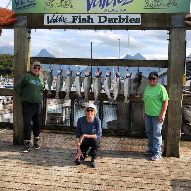
AND then was the drive to Valdez, Alaska! Oh my gosh.
August 1, 2019
When we departed Palmer we drove the Glenn Highway. We turned right on Richardson Highway, AK 1, south. Passed through Glenallen and Copper Center. Typical Alaska towns of 100 to 500 people.
Most of the roads in Alaska ribbon out for semi-trucks that bring in supplies of all kinds. They pick things up in the seaports and bring stuff up from the Lower 48 and Canada. They haul rocks, lumber and fish to ships. I talked to a trucker for a while one day.
Getting gas after Glenn Hwy, I chatted with a full-time trucker who drives six trips back and forth per year through BC, the Yukon Territory and Alaska. No matter where you go in Alaska – road construction is happening. Gravel. My trucker pal said he especially dislikes the ‘weekenders’. Guys who drive on the weekends and are paid by the load, they make more money speeding like crazy from place to plac
Previously on the route, Scout’s windshield had been popped (and repaired) and we’d lost a fog light as well. Trucker said that every single trip (and he makes long distance six trips a year) he looses a windshield. He laughed and said that’s why he drives a split window tractor – he about always has one windshield that’s clear!
By this time, both Barb and I were feeling pretty inured to splendid mountains and blue laced glaciers… can you believe it?
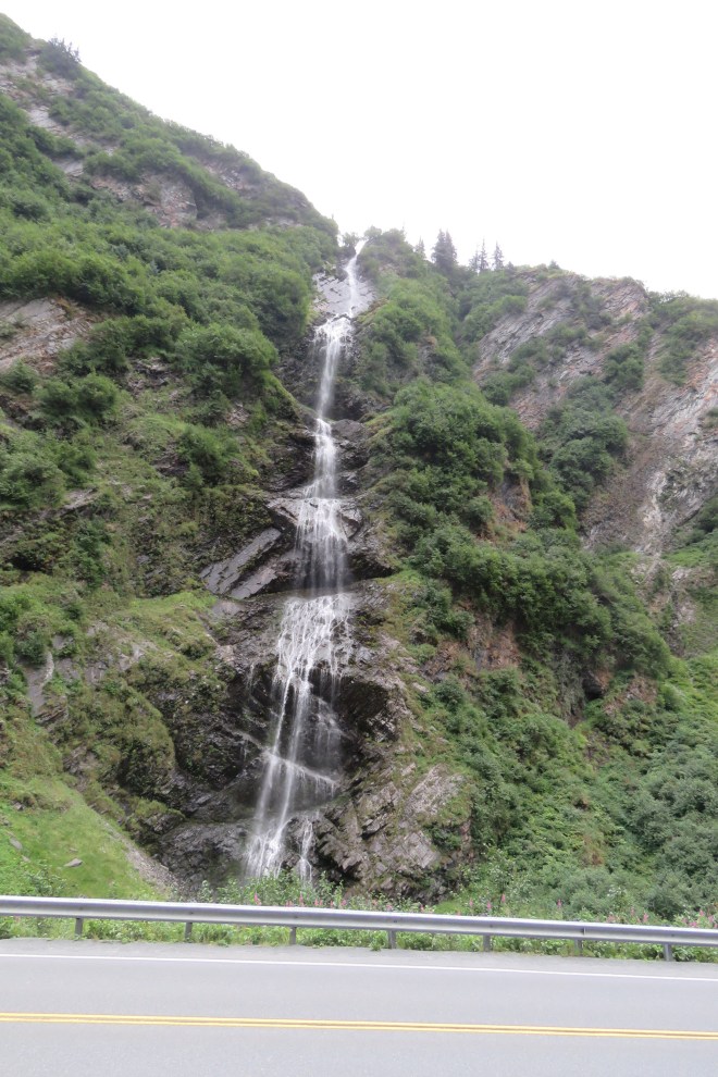
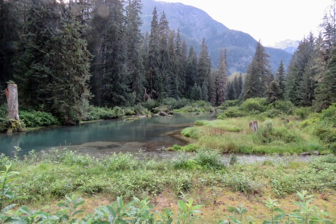
First off, the road down to Valdez follows the usual rivers and streams. In this case, as in much of Alaska, the water flowed north. Yup. Not down to the sea. Clue – mountain range ahead.
Once again, no matter how jaded I thought we were, Barb and I had our minds blown. The drive down to Valdez is more striking, more astounding than the previous two had been! It’s nuts.
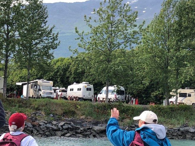
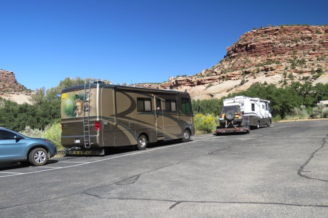
Barb and I, as Wagon Masters, needed to boogie ahead of everyone else. We check in to each campground, designate sites for each rig based on size and folks need to be near the bathrooms and to put gals who like to park in adjacent spaces together. It’s a bit complicated depending on the amount of time we had before the first rigs arrive as well as the state of the campground map.
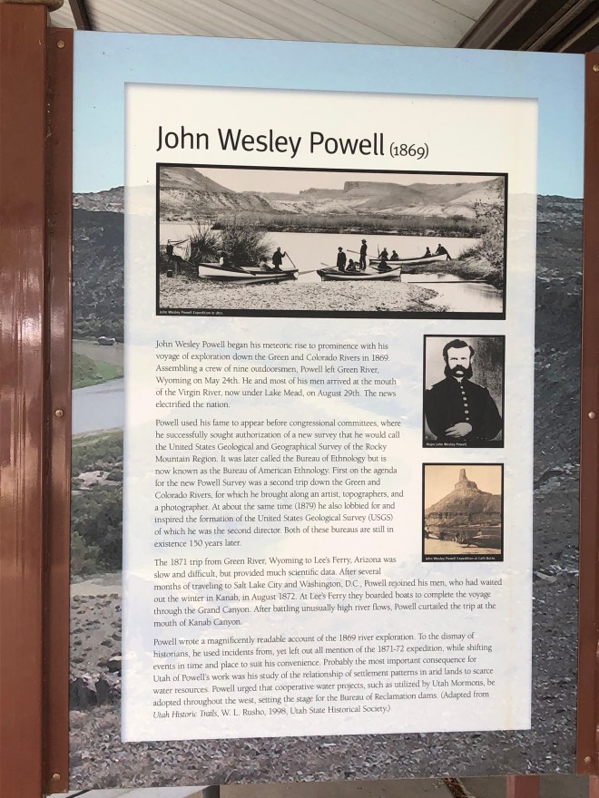
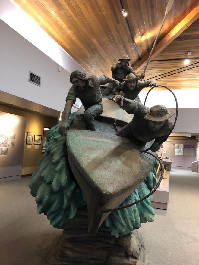
So, boogie we must, but on this drive we were not going to miss an important stop, the Wrangell – St. Elias National Park! Barb and I are avid National Park visitors and we have an ancient NP Passport book we’ve been filling with stamps since we started RVing together 33 years ago.
Wrangell – St. Elias NP is similar to Denali NP in that there are few roads and much wilderness that is nearly untouched. The Visitors Center is small and serves mostly hunters and travelers like us. It wasn’t a lengthy stop but we saw tons of pictures of the park and it’s wildlife. Along AK 1 drivers are treated to views of the Wrangell Mountains – Mt. Blackburn 16,390’, Mt. Wrangell 14,163’, Mt. Sanford 16,237’ and Mt. Drum 12,011.
https://www.nps.gov/wrst/learn/nature/geology.htm
Within the park are four mountain ranges, the Wrangell, the St. Elias, the Chugach, and the Alaska Range. Ten volcanos have been identified within the park with Mt. Blackburn being the most recently active. This is where that massive 7.9 earthquake hit in Nov. 2002. The earthquake literally upended, flipped, cracked, slid and shook the park into a completely different sort of topography than had been quietly resting for thousands of years.
Okay. Maybe not so jaded.
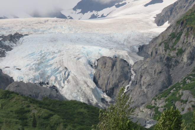
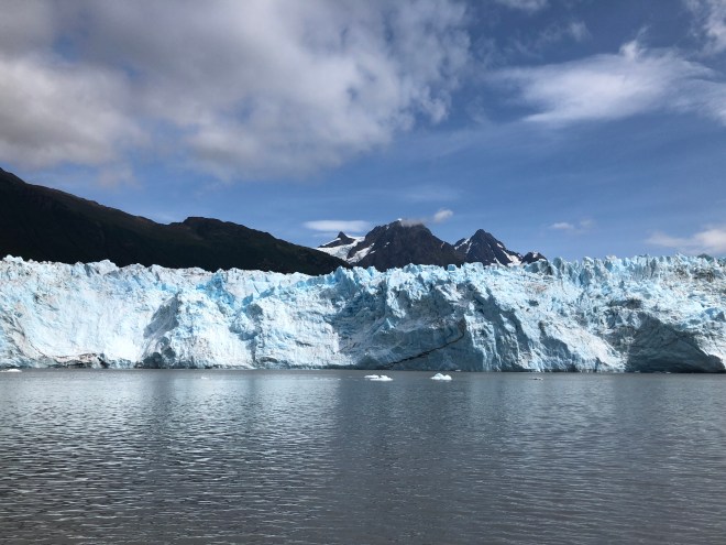
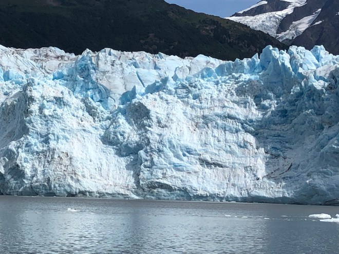
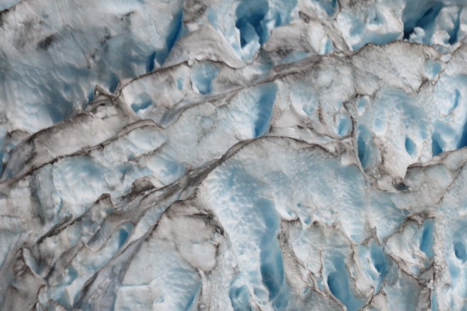
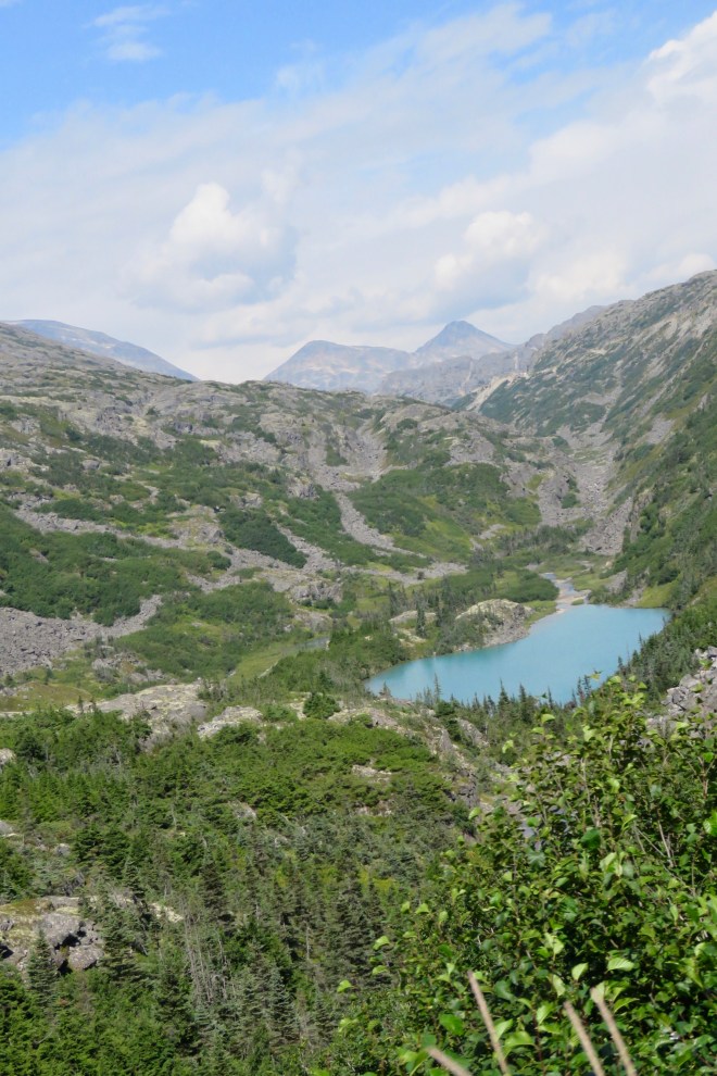
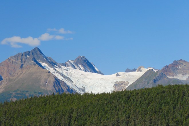
Then around a bend comes an eye popping view of Worthington Glacier.
https://www.alaska.org/detail/worthington-glacier
https://www.alaska.org/guide/valdez-to-worthington-glacier
The drive from Valdez to Worthington Glacier –https://www.alaska.org/guide/valdez-to-worthington-glacier
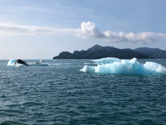
Unlike many of the glaciers we’ve seen, Worthington isn’t in a high mountain pass or valley dripping into the sea – this is a valley glacier. It’s about 5000 acres. The road we’re on is above the glacier so we can see its blunt face, charcoal colored top layer and cracks glistening with blue ice.


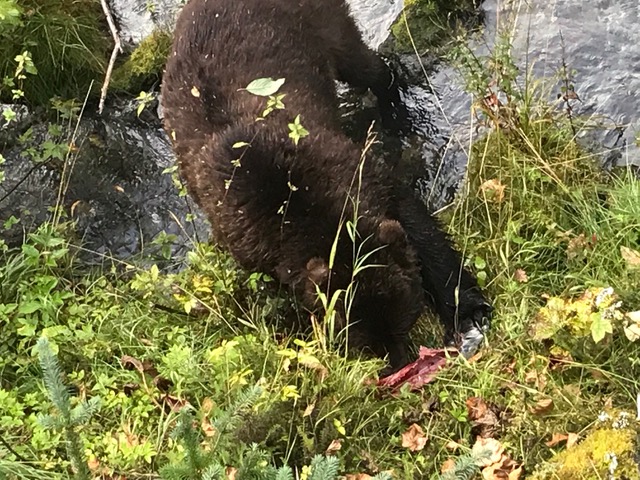

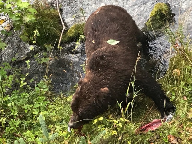

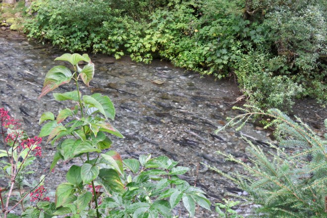
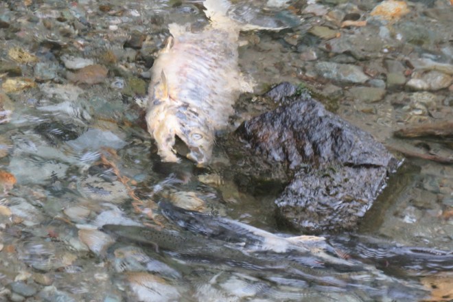

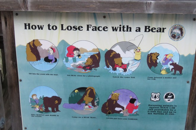


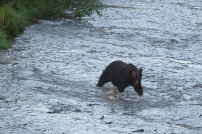
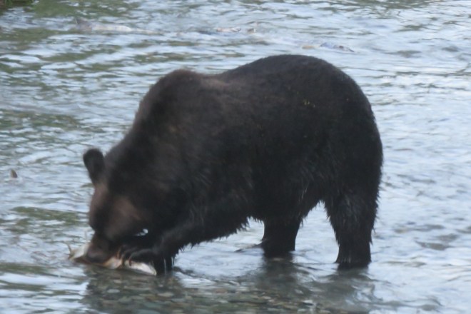

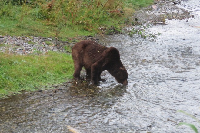
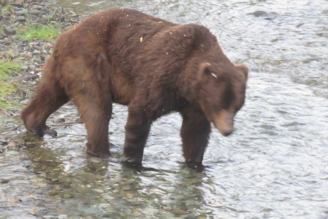

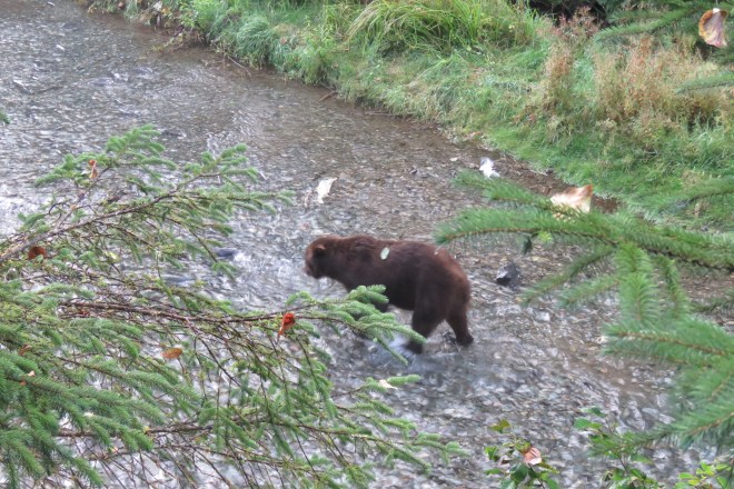
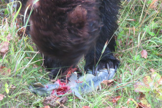
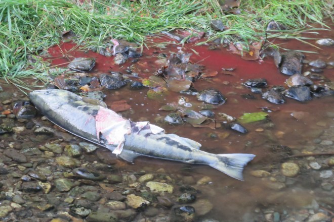
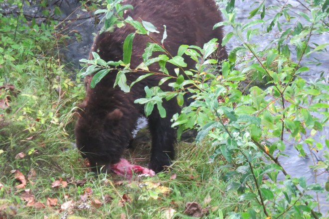
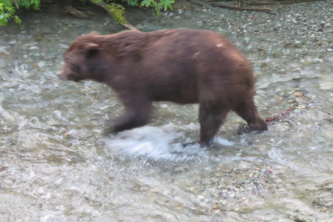
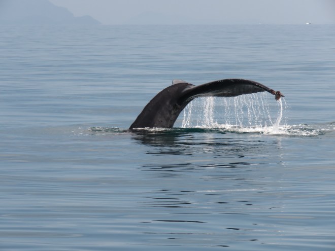
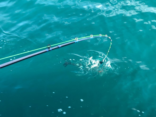
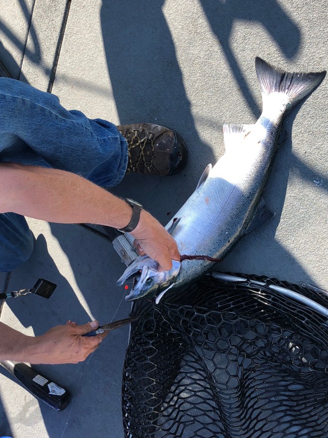
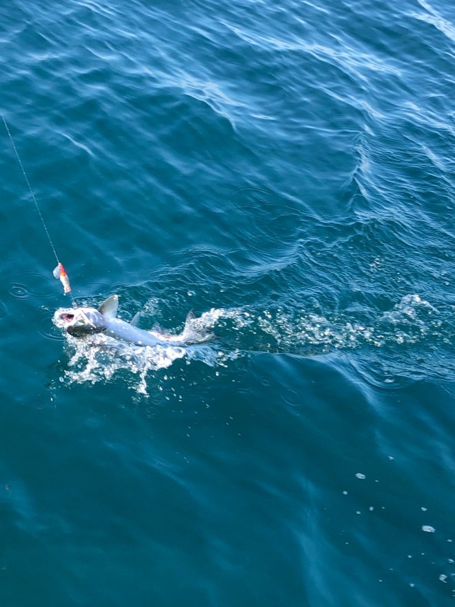
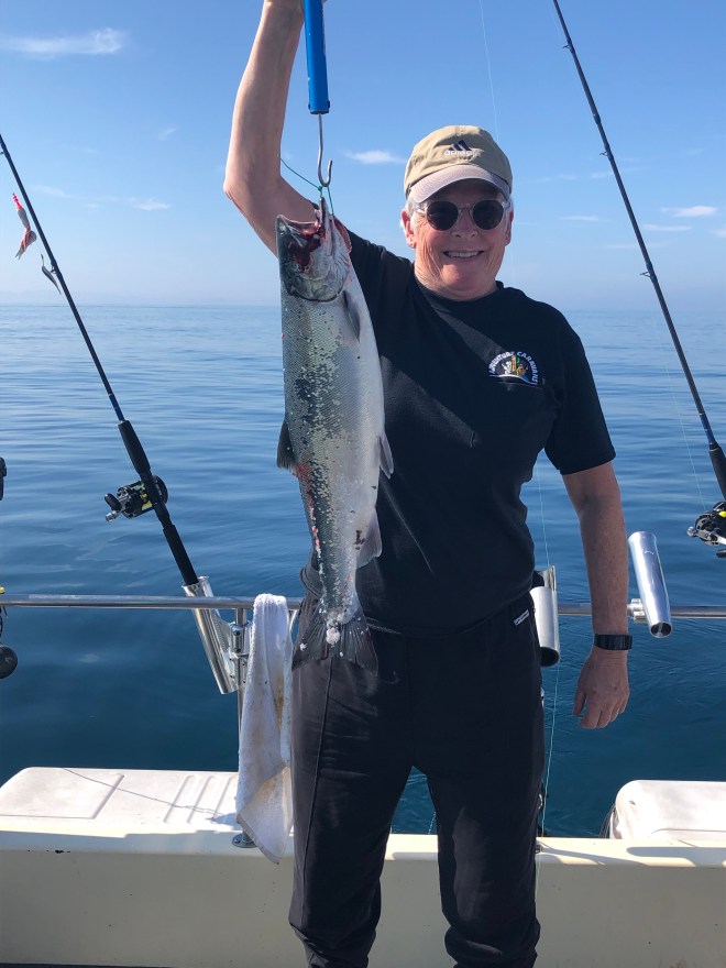
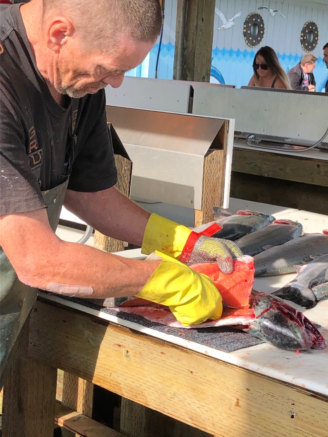
 That orange stuff around the torn up salmon? Eggs. Not every egg makes a fry.
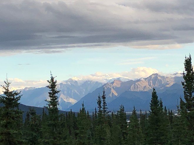
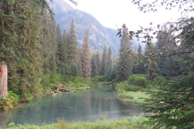
 Here are the TORMENTS (isn’t that name just perfect?). The land was potholed with lakes and ponds and pots of water all reflecting the amazing blue skied sunny day.
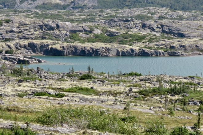
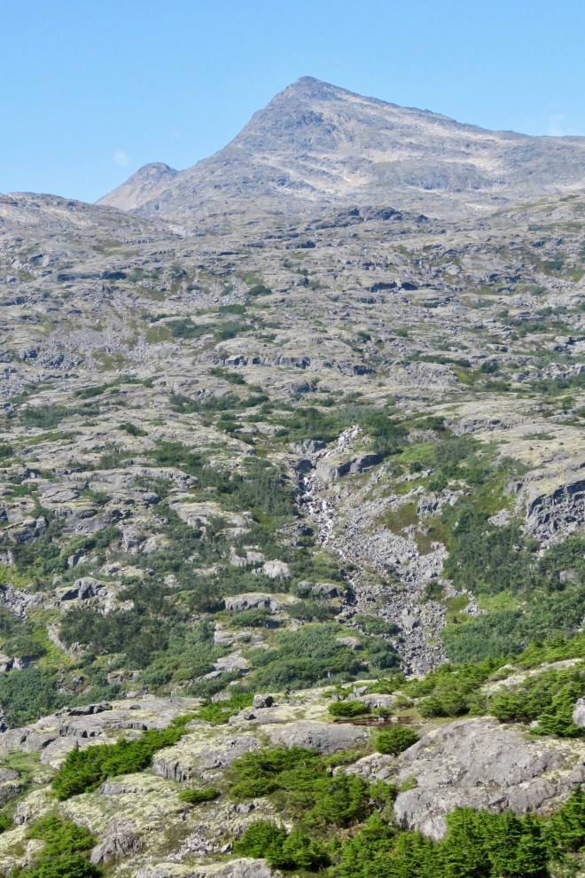
 The land went flat and TORMENTED for miles and then began it’s usual descent to the port.


 Or… lets just get out of town.
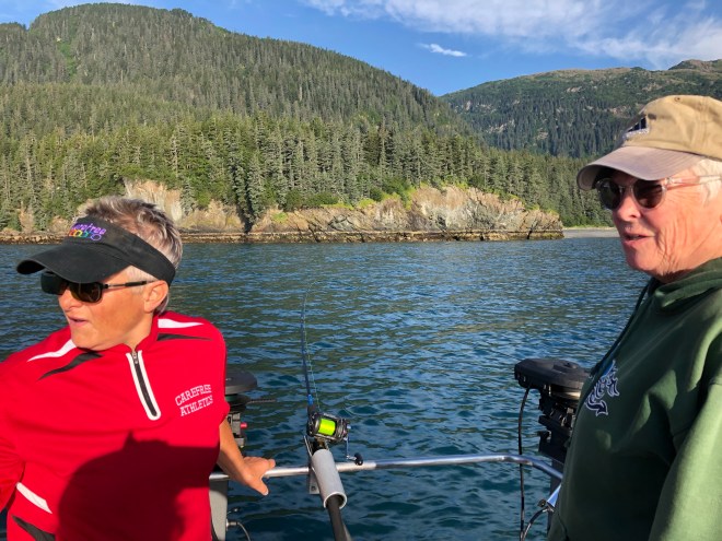
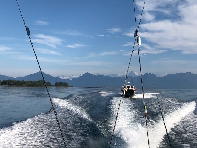
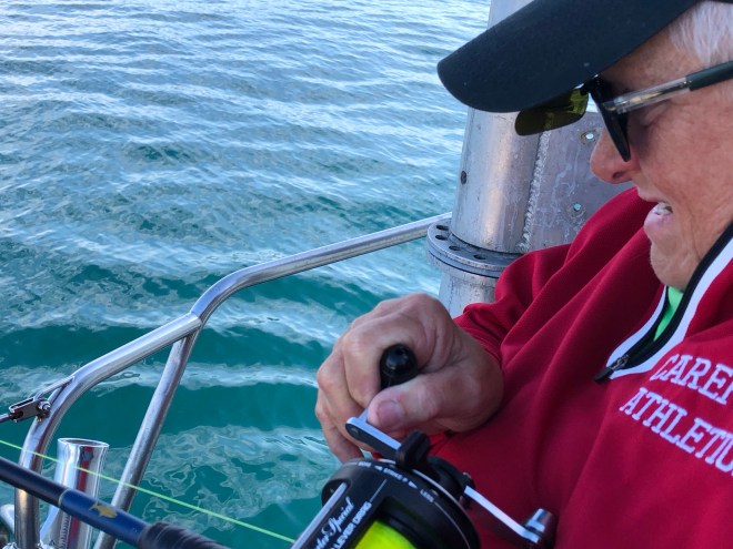
 On yet another nice day…
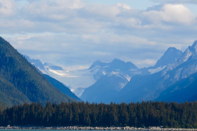

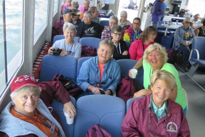
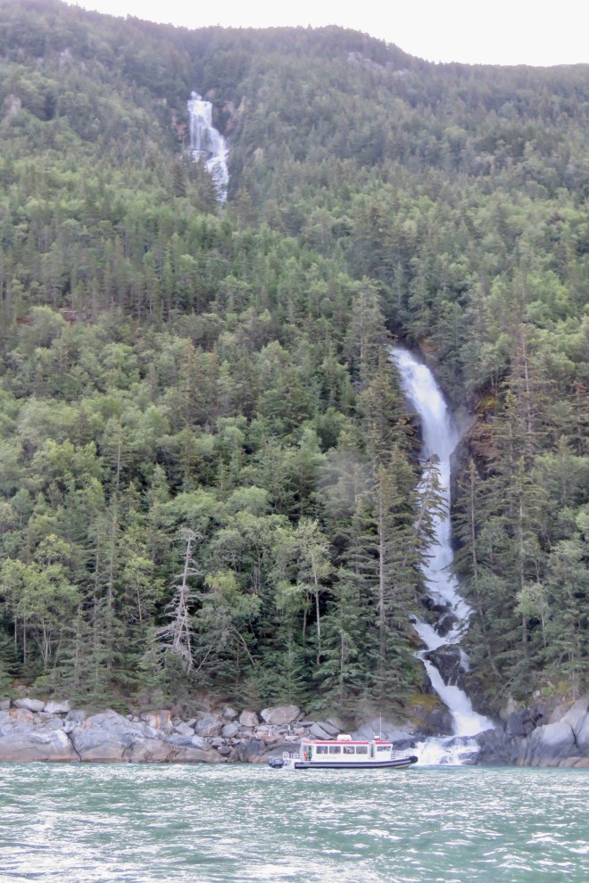
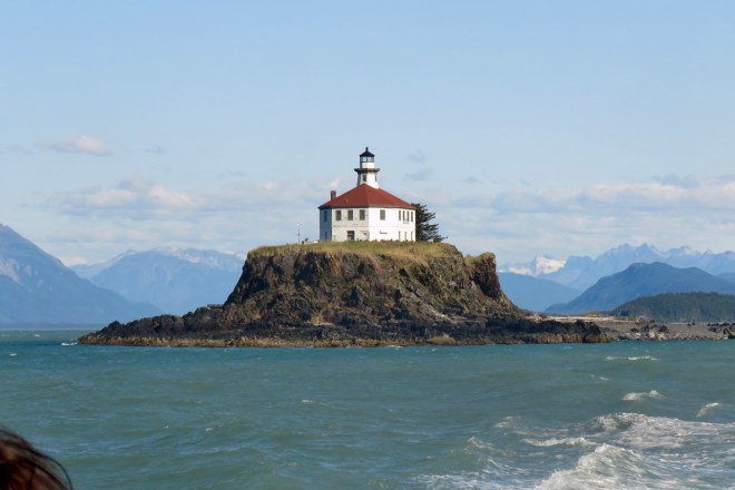 When we reached Juneau, everyone headed off in their planned directions. Barb and I went to meet Susan and Robin, friends from the SF Bay Area, for lunch. They were heading out on a boat to go pelagic birding and wildlife viewing for a week. Though we were a bit jealous of the birds they would see. LOL.


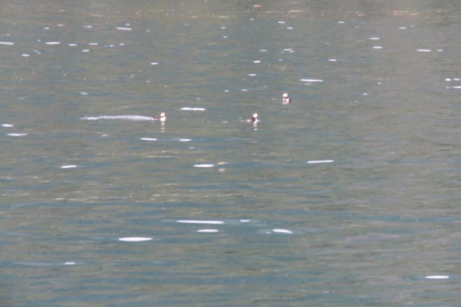
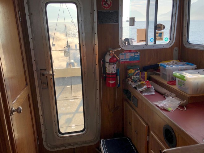
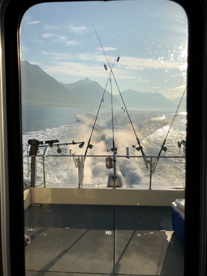
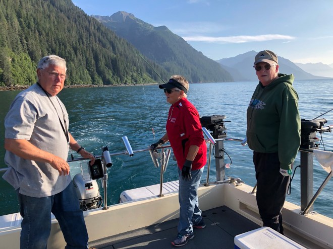
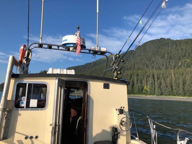
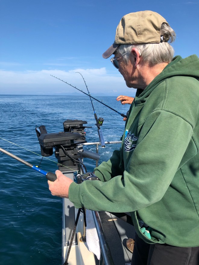
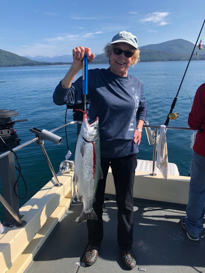
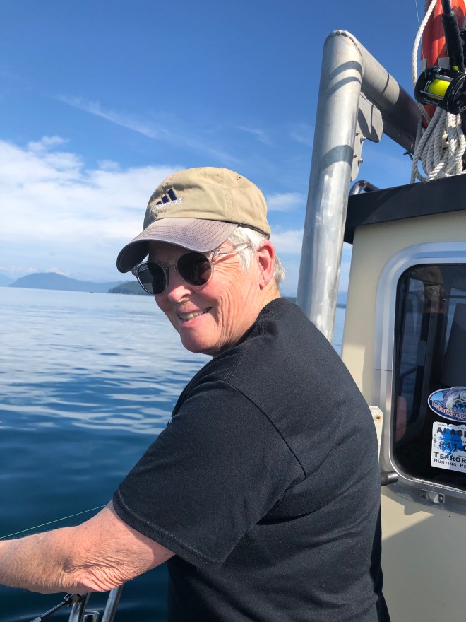
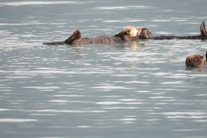
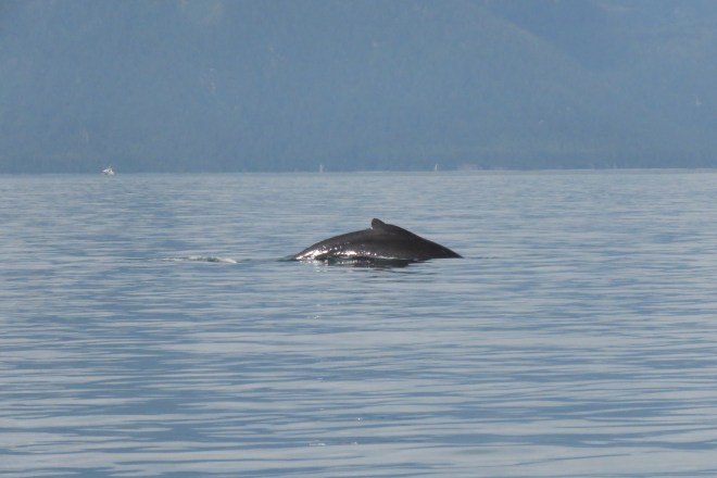
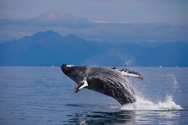
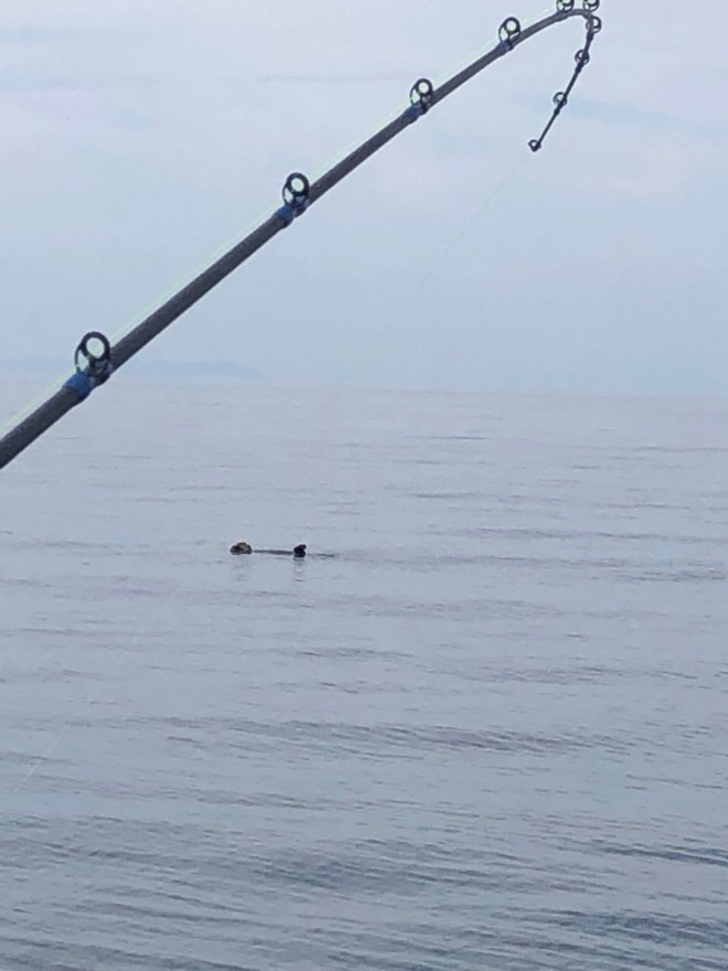 We had an absolutely capital day. Sunny enough to take jackets off. Sea otters, puffins, murre, kittiwakes and murrelets iced the cake, for sure.
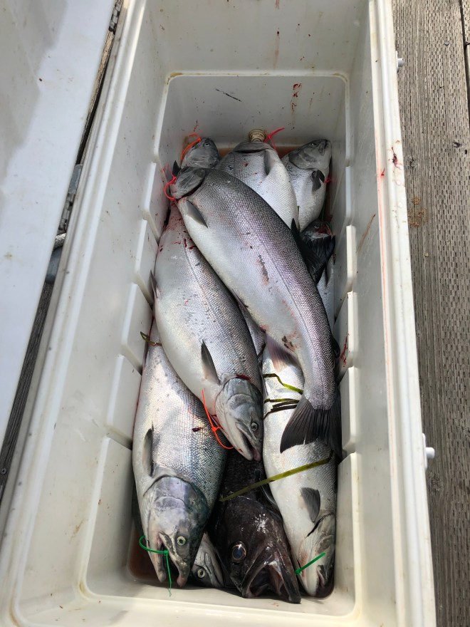
 I even kept the bellies and my son smoked them for me. My recipe was too salty, though. With hope we can try again another time.