The Four Days In-a-betweens

So, I said we would be back in about a week… 4 days will do, I hope.

We found a flyer for a bakery in Tehachapi and, you know me – bread queen, we had to go into town to discover Kohnen’s Bakery. This is a fine, real fine, German Bakery. We got Volksbröt, Brötchen and some genuine water Bagels and ate Danish and a Bear Claw. I know… not super healthy. I ended up with the same stomach ache I get when I succumb to some kind of masochistic external pressure (from my memories) and eat a donut (dognut, guys in my group will get this…). Ugh. Barb just shook her head – she knew I’d have problems with that sweet treat. The stomach-ache pretty much was a precursor to driving down into the Central Valley of California.

For some reason, the pollution index was off the charts – 2 miles visibility, maybe. Trash knee deep along the road and we were on Hwy 99 heading for Chowchilla. Hwy 99 has to (have become) the most epically bad road on the planet. Potholes as deep as swimming pools and ruts, tears and buckles that sent our RV into seizures. It is a horrible road!

Luckily, Barb is the consummate researcher concerning sites to see along the way. She found us a place off 99 – going in the right direction – with a lovely sheet of asphalt for us to cruise, CA 43 (north of Bakersfield) to get us to Allensworth State Historic Site and a good ways beyond.

We stopped to check out Allensworth because it was another puzzle piece in our learning. After we parked and paid the day fee, I took the shot above of the gorgeous purple plants growing everywhere we looked. We unloaded the bikes and set out to read and peer into windows of the restored buildings. Being as it was a Sunday, we didn’t expect to see the docents in costume of the time, or anyone really.

Allensworth is the remains of an almost utopian vision that Lt. Colonel Allen Allensworth created. The Colonel was born in 1842 into slavery, he escaped and joined the Union Navy. After getting out of the military he got his education and became a chaplain and joined the Army to be chaplain to African American soldiers. In fact, he was the highest ranking African American officer in the U.S. Army when the retired.

In 1908 Allensworth, Professor William Payne, Dr. W.H. Peck, Harry Mitchell and J. W. Palmer brought together the energy and money to buy acreage to create a town: Allensworth.

The town was to be for African Americans to live, own land, own businesses and worship in freedom and out from under segregation. It was a rousing success – in the first 10 years; now you need the REST OF THE STORY! They had bought the land from a white man who founded the nearby town of… You know what? Why don’t you read about it here. There are good photos and it’s a really deep, complicated and wide story. Please click and read about Allensworth!

We enjoyed being in this restored town adjacent to the living community of Allensworth. We watched the parks movie and heard from children of original families, looked in the buildings and talked to an incredibly generous ranger (who appeared after a park groundskeeper let us in to the Visitors Center and turned on the film for us). For a hotter than heck Sunday these folks made this stop come alive and we’re grateful.

We hopped back on CA 43 to go north quite a ways until we were forced to get on Hwy 99. Jeezelaweeze… luckily I still have fillings in my teeth, that road about rattled them out!

Since there is no RV park in Atwater or Merced (that wasn’t a year round live there sorta place) we stayed down in Chowchilla at The Lakes RV and Golf Resort. Its at exit 170 off 99. The park is clean and the pool is the cutest thing you ever saw and a surprise in drought stricken California (it’s a kidney bean about the size of a 24’ RV). We did laundry in the clean and incredibly affordable laundry room and walked the park every evening after dark. Sure, the sites are a bit sardine-ish, but there are bushes between them, trees planted and pruned so awnings can open and a most amazing sight (well, to me anyway); old, old oleanders trained into tree shapes, like lollipops, with trunks 4” around (old).

Business went well and we met my step-sister Nancy for lunch at my dad’s old haunt The Branding Iron. We raised a glass to him there (he frequently closed the bar with his parties of friends and family). It was amazing to compare memories and catch up on the folks we knew. Nancy is a pretty good historian for the family, wish she’d write things down.

They once had the most amazing food. My dad, Jack Wharton and step-mother Sylvia put their brand on the wall. Nancy remembers it as a circle around SJ. I found a brand without the circle and we just assume that’s how it was done at the Branding Iron. I include an unknown brand of a sun. My family company was Sunshine Hatchery. I have a sign from one of the ranches (we had many of them, raising turkeys and cattle) that has a half-sun with alternating yellow and white beams. There are three yellow beams that signified the three brothers, Jack, Jeril and Don (Duggan). I don’t know that they ever had a brand, but this little guy reminded me of the sign posted in my office at home.

Things change and so has my part-time-home-town. Merced is pretty tattered until you get to the north east of town. Old Merced with her elegant craftsman homes and big Victorians seems to have been left behind somehow.

Most of the time we’ve been in the Valley the pollution has been blinding. Today, for some reason, the Sierra’s were visible as dark grey hulks outlined by clouds. It was good to see the mountains. When I was a kid, we would come over Tejon Pass or out of Yosemite and look out over the valley; it was bordered by towering snow topped mountains on one side and foothills on the other. The orchards and fields shone bright greens and water like mirrors wound it’s way through canals. The San Joaquin Valley was a beautiful place.

Tomorrow we climb over the western foothills aiming for Anthony Chabot Regional Park above Oakland. Looking forward to seeing our beloved friends and the place we called our first home.

Nevada Border to Tehachapi

July 22

Traveled some super boring country today. Out of Nevada and into California. Every little ‘town’ we passed was thoroughly trashed. There was trash everywhere. Amazing. We’re in California desert and this is by far the trashiest place we’ve been!

One mountain we went down offered us a rather alarming sight. We watched these three standing lights for miles. I finally had to look it up! Turned out to be the Ivanpah
Solar Power Facility. This is the worlds largest thermal solar plant at 6 square miles. There are three huge towers that have miles of reflectors all focused on the tops of the towers. The heat collected there turns huge steam turbines to generate enough power to light up about 140,000 homes – and reducing carbon emissions by 400,000 tons annually. The water is all recycled through the plant so there isn’t much waste. It’s pretty weird looking! The cost of providing all of this power is steep. In 2016 federal biologists said about 6,000 birds had died from collisions of immolation annually while chasing the insects attracted by the towers.

We took I-15 to 58 and across the Tehachapi and stopped at Mountain Valley RV Park. The park is adjacent to a glider port – we got to watch gliders pulled up for launch and then landing. Pretty cool – the Tehachapi Wind Farm in the background was another interesting alternative power source for Calif. Wind farms are also terribly hard on the raptor population. Heck, cell phone towers with their blinking lights cause significant deaths of song birds every year.

The next few days are going to be consumed by business kinds of things so see you in about a week.

California here we come!

July 15 – 17

(16th 9:10 pm)

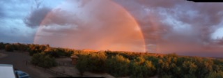
Oh friends… Cindy, Tom & Thayer, Max, Freddie, Mahala and all the dear hearts who follow us… I so wish you were here. I just broke off and came inside to try to describe to you the mesmerizing skyline surrounding us tonight.

Let me set the scene. It’s deep dark out. There is no sound. There is a high cloud layer thick enough to block the moon that extends for miles around this basin we are in (Scottsdale, AZ).

Imagine the Northern Lights but, not.

This is a true desert light show. My dad, Jack, called it sheet lightening and we would sit out in lawn chairs at our funky fishing “lodge” in Wildhorse, Nevada, to watch. The adults getting more inebriated and the kids falling asleep gradually as the show went late into the night.

In a wide arc – in the sky above, north to northeast and to the northwest – of us lightening, not the jaggedy kind but huge sheets up so high they are unseen, lights the upper atmosphere. Wild snaps dance around the horizon brightening miles wide swaths of sky to dusk levels of light. The hidden moon is illuminated, the towering clouds are illuminated, and the mountains are shot in sharp definition. There is color. A sunset orange tone, lavender and pale pink, white and an almost blue color fly above the clouds.

It’s as if light is dancing, the earth her willing partner. I wish you were here to be captivated. I imagine your eyes darting around and above to try to find the prettiest sight. You would sigh and wonder at the incomprehensibility.

15 July, Back to Reality:

This day was stressful! From Roper Lake State Park, we headed up 70 through Geronimo, Bylas and Peridot to Globe, turned down 60 and made our way to Fort McDowell, AZ to a commercial RV park – Eagle View RV Resort. We drove through several tribal lands and, though the map neglects to mention it, up the mountains and down again. I will say the road was (mostly) new and (mostly) had reasonable passing lanes to let cars pass slower vehicles on the uphills.

On the 7% grade downhills – yes, 7% look find out what that means to a vehicle weighing around 20k – please, because we sure found out!!! On the downhills, there were no passing lanes and the cars LINED UP behind us. Deal is, Barb had to gear way, way, way down and use engine braking (thank you, Workhorse engine) to keep us from hurtling down the mountains. We went slowly and pulled into runaway truck lanes to cool the brakes and let folks pass. At one point we unhooked the car so that weight wouldn’t be pushing us. Ironically, we were near the end of the downhill when we finally did that…

[9:52 on 16 July: The storm from the skies has finally reached us. Rain. There is quite a wild lightshow and the wind is intermittently rocking the RV now. Barb says… Monsoon Season in the desert! .]

As soon as we got out of the Mountains (elevations over 3000’), around Apache Junction, the big city traffic and roadways took over. Good reminder for us of why we are enjoying smaller highways!

We made it to the park, registered in the pleasant reception and ‘clubhouse’ area and went to our site. Our site had a spindly tree behind the RV. The park is mostly asphalt with some rock divider areas planted with cacti. There is a very small pool, a clean laundry and a fitness room I had no time to visit.

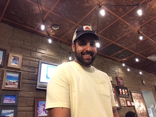
As soon as we got hooked up we took off to visit Scottsdale’s newest museum: Western Spirit: Scottsdale’s Museum of the West. Spirit Museum Link
The Museum is a LEED Gold Certified Eco-friendly building design and houses the most amazing collection of Cowboy, Trapper and settling of the West ART. The Museum is currently showing: “The Rennard Strickland Collection of Western Film History”; “Of Spirit and Flame: John Coleman Bronzes from the collection of Frankie and Howard Alper”; and the ongoing exhibition of “The Abe Hayes Family: Spirit of the West Collection”.

We tried out the horse painting that ran from wall to floor – not bad!

If you are in the area, this is a spot that you must visit. The building is gorgeous and located near Old Town Scottsdale. The collections made me feel as if I were born in the wrong era and yet… glad I was born in the time of Cowboy Movies. Rennard Strickland’s collection was amazing – from billboard to postcard sized movie posters and broadsides. From chaps and spurs to sculptures and fine art, this museum shows you the West.

Another museum we visited was MIM: The Museum of Musical Instruments. I expected to be disappointed, mostly because I’d visited the Musical Instrument Museum in Brussels, Belgium. We didn’t have much time because it was our last day, so we got there when they opened. We still did not have enough time! This is a fabulous museum with free headphones, they come on when you stand in front of a screen that shows the instruments in any given display being played. People sing, drums beat, people dance and watchers just can’t hold still! About MIM

Being Frank Lloyd Wright fans, no visit to Scottsdale would make any sense without a trip to and tour of Taliesin West (pronounced Tally-essin) Wright’s winter home and school. Both of us were captivated by how Wright used the mountains and lands to create this very modern community where the outside is constantly brought inside. Five of his original students along with a cadre of current students continue living and working at Taliesin. Contemporary art from furnishings to the walls, the architect worked on the property constantly until his death. At first, there was no glass but as Wright stayed longer each year, the canvas curtains were replaced – which did nothing to ruin the invitation of the outside to the inside. As the two of us reflected on our experience at Taliesin, we drew parallels between Wright’s work and that of a later contemporary artist, Donald Judd. Furnishings especially reminded us of those Judd made and as we read the Interpretive Guide, we found that Wright had influenced Judd.

We went to see Barb’s Aunt Ginny twice a day and very much enjoyed being with her. Though she is 97 and her memory is a little like swiss cheese, reminiscing was no problem. She and Barb had so much to talk about! She remembered me the third time we visited, no mean feat that! I enjoyed watching her mannerisms and hearing her speak – so much like Barb’s mom, Kay. Aunt Ginny seemed to enjoy the visits and asked the staff what could have delayed us one day for our second visit.

We also did a bunch of grocery shopping etc. and had a pretty darn good meal at a local brewery: O.H.S.O. Distillery and Brewery. The beer though shot this place out of the park.

IMG_3230

One night we fell into a little local place, Saba’s Mediterranean Kitchen for dinner. A tiny restaurant that serves delectable food – Greek mostly. There was one server who showcased the Greek Flaming Cheese presentation – wowzers! We had George’s Caprese (5 stacks of mozzarella and basil) and George’s Spanakopita which was the traditional spinach pie smothered in the restaurants Avgolemono soup (sauce). Both were memorable. Jared was a great server! Saba’s Link!

IMG_3212


Interesting town and we would love to come back for another visit with Aunt Ginny!

From Scottsdale (in a valley at 1248’), we went to Congress, AZ, via US 60 and SR 89. Climbing up and over to end up in another valley at 3314’.

Why would we do that? Well, Congress is kind of in the middle of nothing… BUT! The Escapees have a park there – North Ranch Escapee’s Park. At the park is Weighmaster Ron James! Ron is an amazon.com author who writes about his cat (who is a butterscotch cat, but believes he is solid gold). We stayed the night, washed the Caliche off our rig and got weighed! Wheel by wheel both the RV and the tow vehicle. Ron gave us a GOLD STAR! We are underweight for our chassis, don’t pull too much weight and have the tiniest bit of shifting from side to side to do. Huzzah! Smart Weigh by Escapees

Weigh in completed we headed for Dead Horse State Park, AZ. The roads were good – we headed on SR 74 to I-17 and then up to Cottonwood, AZ. Barb is loving the mountains but I loved being close to Red Rock Country: Sedona.

We took a day for Sedona. First, the views are amazing and the colors mind blowing.

We drove to the trailhead for Boynton Canyon early. This is a 5.8 mile (RT) hike, with a 400’ gain in elevation – the first part runs along the “Enchantment Resort” which was NOT enchanting. After about 1.5 miles, you get to silence. No car noise, no beeps, no people talking. Hawks were playing in the sky above us, between the red rock spires and slopes, deer fed along the trail (nonplussed by us human’s huffing our way along, and we walked into a forest). Cool breezes blew the heat from our bodies and the silence. Heaven.

Fwop-Fwop-Fwop-Fwop-Fwop… You know what that means! Helicopter. Right over head. I was incredulous. Tourist’s who don’t want to hike, I guess, just hire a noisy machine to help them see? Urk!

The hike was lovely. Several times on the way in and out I felt super-energized, light weight and moving (despite the sweat and heat) was easy. There were two places though, that I felt like my feet were lead, I needed a nap and almost fell asleep while I walked… go figure. Maybe vortex energy? Anyone care to weigh in on that idea?

After the hike, we consumed ten tons of water and our remaining food (which we had left in the car) and headed to the Amhitaba Stupa Peace Park in Sedona. It was lovely, quiet – nobody there but us for a while – and though I was exhausted, I felt energized when we left. My feet even stopped hurting! We walked the traditional three turns around the Stupa praying for compassion and healing for all beings. I prayed that the folks leading this country are infused with compassion that pushes out all greed. I prayed for Cindy and for Aunt Ginny and for Erin and the baby, healing and love.

Since we were there, we looked for somewhere to eat lunch and settled on ChocolaTree. Who could resist that name? Turns out it was a very interesting place to eat. Not only was everything organic, GF, mostly raw, and live but much of the menu was available to buy to take away. Please, go to their site and read their story – it involves cacao growing and a chocolatier. Interesting read on Chocolatree.

We could easily return to Sedona and Cottonwood to check out all the wineries (yes, Verde Valley Wine Region) and enjoy gorgeous Dead Horse State Park on the Verde River. So much to see there and walks to take! Luckily we have TwoGalsGo to remind us of places we must return.

Today – what day is it anyway…. checking… Oh 21 July! Wow, how did that time pass so quickly.

Today we drove through Cornville, AZ to I-17 N as far as elevation gain 6500’ at Munes Park) Flagstaff (elevation 6500’),where we hopped on I-40 W – continuing up to elevation 7070’ – which encompasses part of the old route 66. Then we went down several 6% grades (we weigh 21500, towing). Thank goodness for our 8.1 Vortex Workhorse engine with engine braking.

We went as far as Kingman (3033’) and thought we’d take a shortcut on SR 60 to the other side of the Colorado River and Bullhead City, NV (540’) (and I did not miss a zero). This was technically a shortcut – mileage wise but this route was elevation-ely challenging!

From Bullhead City we got on NV ST 163 and crawled on US-95 N… climbing to Searchlight, NV at 3540’. We hung a right on Cottonwood Cove Road to get to our Campground DOWN on the Colorado River – it was another drop of about 3000’.

Cottonwood Cove, on their website, looks lovely. In reality – I’m sorry to say, the RV park is about the worse one we’ve ever been in. Sites pony one on top of each other. Ugly, trashy, and dog poopy. Lake Mojave is lovely. Sky blue and inviting, we would have been swimming if the temperature wasn’t 111* and the walk too long to bother with.

RVing TIP: Fellow RVers. Please don’t do this to yourselves. Either inflict these elevation changes (UPs and DOWNs of an Rver’s life) upon yourselves at all or please, don’t do it in June. Feel free to shake your heads and chuckle over our wacky plans. Just don’t do it unless you are serious desert rats and don’t mind outrageous temperatures! The worst part? We are climbing back out of here again tomorrow! I know, a week playing on the lake in our own boat, heaven… leaving tomorrow, not so smart. Phew. I’m caught up for a bit. Next stop… Central Valley, Calif – staying in Chowchilla, Ca to conduct business in Merced, Ca.

Arizona. Is this West enough?

Arizona. Is this West enough?

July 8 – 14

Thank you so much for joining us on our travels! It’s fun to write with the idea that you’re listening.

From San Angelo we took 87 to Big Spring and 176 to Eunice. It was lunchtime so Buck Vandermeer and his buddy Robert Eustace met us at the Outlaw Grill. They drove down from Hobbs. We had a great visit, learned about Robert’s business and listened to Buck’s stories. Buck was Barb’s high school English teacher, now a good friend.

Buck explained that most of what happens in his next book actually happened to him. It was sure fun hearing about it. We’re going to do some editing for him before he publishes the book. From what I’ve read of it, it’s characters are engaging and the situations imaginable.

BTW, The Outlaw Grill is a real gem of a place to sit for a meal. The staff take immense pride in the food they serve. My lemonade was hand squeezed, with unsweet tea, raspberries, blackberries and strawberries. Barb and I split the Green Chili Chicken – chicken breast with a crispy crust of tortilla chips, draped with green chilis, sautéd veggies and two slices of bacon. This was all smothered with white Queso and sitting on top of a pile of mashed potato. It was delish and I plan to try to copy it (without the bacon). It is a dish that needed to be shared!

Eunice is really small. Set right on top of the Permian Basin Oil Field, there were miles and miles of Nodding Donkeys or Rocking Horses, as the piston pumpers are so referred, as we drove there and away. We saw lots of the equipment and well heads used in Fracking. I had to read about that process. It’s a way to extract blood from a turnip, really. It is pretty scary that the process blasts apart chalk of shale deep underground with huge amounts of water mixed with sand or aluminum oxide. Once the oil’s gone, the ground is left pretty unstable.

Here at Brantley Lake State Park, north of Carlsbad, there are short shrubby trees and bushes that are covered with little purple flowers. It’s really hot so we’re using the grill and eating mostly cold stuff.


IMG_3172

Barb, official blog photog, got up on the rig’s roof and got this photo of the sunset tonight.


July 10

We beat the heat and left early for Rattlesnake Springs, south of Carlsbad Caverns National Park. What an interesting spot! It was set up with a complex irrigation system over an underground spring. It’s really an oasis. The birding was just superb and the photos we share here all came from there. I got to stalk a bunch of wild hen turkeys as they fed. Did you know that some hens have a “beard” – all of these did. These birds were big, tall, American Bronzes. Their legs completely dwarfed anything you’ve ever put in the oven! I really loved their colors and one hen opened out her wings for me – a real treat.

Barb did her own patient stalking of a Summer Tanager. This photo is, I think, exquisite.

IMG_2652


Then, we went up to Carlsbad Caverns NP. On the way in, I spotted this handsome fellow and a couple a’ ewes, y’all, on the canyon walls. Shot from with the iPhone from a rolling car!

IMG_2660

We checked out the visitor’s center (nothing special really) and then walked out to the Bat Amphitheater

IMG_2663

and down into one enormous, deep, dark hole.

IMG_2664

Taking the “Natural Entrance Self-guided Tour,” we walked down for about a mile. There was lots to see on the way down in terms of Speleothems (formations). Down steep zig zagging paths, not something my hamstring (pulled during leg cramps the night before) appreciated.


When we made it to the bottom, we embarked on the “Big Room” self-guided tour. That was 1.5 miles of winding in and around, under and over, looking down and looking at the upper walls and ceiling. There were little lights along the way and the most amazing Speleothems were lighted. I appreciated the lighting, it wasn’t flashy or colored or moving, just the perfect amount of light to give the eyes direction.

The cave was a lovely 57 degrees and a light shirt was all it took to stay warm enough as most of the strenuous walking was out of the way. The elevators beckoned me – I didn’t think the muscle in my calf would handle the mile hike up. Barb was kind enough to agree that she didn’t want to go up those ramps either! One elevator bank was out of order which left two elevators. Each elevator holds 8 people. You have to realize that this Cavern is a world wide attraction on the bucket list of millions… it seemed more than a few of them choose today to show up. The elevator ride on July 4th had a 4 hour wait, according to some, today’s wait was 1 hr. 15 min – doing a standing shuffle. We were glad to get up top and sit in the car.

Neither of us was quite ready to go get groceries and beat feet back to the park so we took (an unguided) 10 mile trip on a gravel road way down into a canyon. Our effort was graced by seeing a couple of Indigo Buntings along the way. Highly recommend picking up the little brochure at the Visitors Center – the trail has markers all the way.

We stopped for a minute at the Rattlesnake Canyon Trailhead to puzzle over and feel sad about the father and son who recently perished on that trail when temps were in the 104* range. The desert is no place to underestimate; it is harsh and unforgiving.

July 10

I didn’t feel great today, maybe I wore myself out yesterday, so I took it easy (4 hour nap). Barb graciously took the laundry into Carlsbad to the (highly rated) Carlsbad Laundry. I include a photo she took there – it’s the one of the dryer with the sign. You just never know what people are thinking, right?

Our next stop is the Organ Mountains-Desert Peaks National Monument. I was dismayed today to learn that Ryan Zinke, Interior Secretary & his appointer have the whole place on the chopping block. With 8 hours public comment left, I wrote, called my AL representatives and posted on FB. Sure hope enough people made comments that the dogs are called off.

Thank you, again, for being my muse and our inspiration.

July 11 – 14

ARIZONA!

I had the flu! Sorry. I can say only a few things about the last few days… 1. Ugh. 2. It’s been really hot and with a fever it was just so much fun. 3. The Organ Mountains were so beautiful, but we didn’t go to the Visitor’s Center in Dripping Springs (see #2).

I know we had a little rain last night here in our campsite at Roper Lake State Park just outside of Safford, AZ – it was wet in low spots. Barb tried to clean some of the Caliche off the car and got busted by the range. In our defense, nothing was said about washing anything in the extensive list of rules we were given upon entry. Yikes.

Today, I felt a bit better so we hopped in the Toad (Car in Tow = Toad) and headed for the Gila Box Riparian National Conservation Area. Close to Safford, AZ where we’re Glamped near Roper Lake.

The Gila Box is a preserved area administered by the BLM (bang up job y’all).
https://www.blm.gov/national-conservation-lands/arizona/gilabox

…’23,000 acres that contains 4 perennial waterways which are he lifeline to an extensive riparian ecosystem.” The canyon, Gila Box, has cliffs and walls that go 1000’ above the Gila River. The river is surrounded by cottonwoods, sycamores and willow trees and an incredible array of cacti.

So, here we are cruising along midst the mesquite, creosote bushes and forests of lush green and blooming Ocotillo. Suddenly, the road drops down and bam! there’s this oasis – a miles long oasis actually! The Gila River is a floatable river and in late spring I bet it would be a ton of fun. This late in the year its shallow – if one didn’t mind frequent portages over rills, it would be a relaxing day’s float.

IMG_2681

We stopped at the Bonita Creek Watchable Wildlife Area for a walk on the cliffs over the river. Right in front of us when we got out of the car was a Black Hawk! Great long watch of this pretty bird soaring on the wind currents. They have a couple of really nice shelters and some interpretive panels and the place is accessible – nice even sidewalk.

IMG_2692We also went to the Dry Canyon Picnic and Boat Take Out Area, the Spring Canyon Picnic Area. and the Riverview Campground. We saw a 4’ snake slither from the river to the brush at Spring Canyon – real pretty pale green snake with dark green stripes. Cliff Swallows had nests in or on (?) the cliffs – they build these mud nests and fill them with desert grasses – surely a warm dry little home for the family.

The Riverview Campground would be good for tenters or high-clearance trailers – a teardrop would do nicely. Pit Toilets were nearby and the fee $5 a day seemed like a good deal to us. Each site was set just over the river and had a shelter with a picnic table. There are a couple of vados peligrosos (flood dips in the road) that a motorhome wouldn’t make it through.

IMG_2687

There’s a lot of country back there to cover and many trails. It’s a place I would love to visit and explore in the Spring.


Back at the ranch… Boom! Thunder & lightening crackle-banging all around us! It came on so fast, I barely got Rudy into the RV and Barb barely got back from birding.  IMG_2708 The air changed, the smell of the desert changed. Maybe because we’re near the lake, there is a smell that reminded me of Pluff – that rich, South Carolina mud; a bit rotty and fecund. We went out after the storm birding (it was 64*) and waddled along in deep mud – soft and smooth as baby powder (brown, baby powder) globe so thick on our shoes that we slid on our own mud. The storm was sure a treat.

The air is clear and we can see the Graham mountains that surround this valley so clearly that with binoculars we picked out the trees up on the highest ridge line. Now, if you grew up on Cowboy Movies, you’ll understand this mental image. I saw these trees, all lined up on top of the ridge and what did I think? It’s the (Hollywood) Indians watching us waddle around with mud thick shoes! I know, seriously? I grew up on too much TV.


West continued…

July 5, 2017.

Interesting drive today; Texas has lots of giant wide shoulders (think of the state’s profile, if you will). No. The roads have wide shoulders and thank goodness, I’ve lived in Texas, so we know the reason. When zooming along and someone comes up behind you (they’re always zooming in Texas) one is expected to move to the shoulder. So, in this wide bodied gal, we smoothly move to the side and the Zoomer passes us with two wheels over the center line. If there’s an oncoming vehicle, they kindly scoot over to the shoulder as well. It’s a good way to go, keeps us from backing up traffic.

Somewhere in Louisiana as we approached Texas, we began to notice little black and white roadkills. Yup, skunks. They’re a smelly presence as we drive along today. Not seeing many dead ones, but we know a skunk has been there and had an unsettling experience… Some people like the scent. Reminds me of coffee roasting in Emeryville, CA or of walking into a 6 X 6’ room where about 30 people have been smoking whacky weed, not that I would know how that smells.

Well, we’re approaching the geographic center of TX. Lake Brownwood State Park is said to sit about dead center in the state. Now, how they determine that is something I’d have to study considering the aforementioned wide shoulders and that little tippy toe foot the state stands on…

We’re going to Lake Brownwood State Park. The lake is a reservoir that was created to keep the Brownwood river from flooding out the towns along it’s banks. Must have been some compromise though! Lose your town to the reservoir or endure continuous flooding. I guess folks decided to relocate. The park was constructed by the CCC – our favorite park builders and favorite federal program (that saved millions of lives and the pride of the nation’s men and their families). They built the dam and cabins at the park. This all took place in the 1930’s.

Campsites are set around circles and are widely spaced – easy to get into and kinda level-ish – we had to go up on blocks in front to manage it. Grassy lawn is the norm with Pepper Trees making up shade and everybody is walking distance to the lake. Lovely sandy bottom without all the usual lake debris made this a tempting spot to swim.

Pulling in, our bow was crossed several times by Scissor Tailed Fly Catchers (see one here)– so we hopped right out (in the heat, yes, it’s still HOT) to go hunt birds. Scissor Tails   (an adult in full flight)are ubiquitous here! Imagine getting to hang out in a place where these gorgeous birds congregate! We also found White Winged Doves, Mockingbirds, Cardinals and hold on to your sox: Lark Sparrows! These little guys hop through the grasses and pop up to grab grains and little bugs. They’re so cute popping up and down through the grass. Really amazing markings (check out this view) (see the black spot on it’s chest?)..

This evening we drove around the park looking for CCC buildings. We ended up standing on the tower of an old stone and wood building (built by the CCC or to commemorate them, I’m not sure). Sunset happened to us. It was a glorious fete of everything one might imagine when thinking about heaven or nirvana. Lovelishous!

July 6

A Short Drive Day, yaaay! 111 miles, supposedly – we’ve found that the GPS and our own calculations are often WAY, WAY off the mark in terms of miles and time. We’re heading for San Angelo State Park near San Angelo TX.

It was indeed a ‘short’ drive to a nice park! Just couple miles outside of town. There are two sections to this giant State Park. Campers and day users check in at the South entrance – that part of the park is on O.C.Fisher Lake. The North entrance leads to a small campground that’s RV ready with 50 amp service. No sewer hookups but there is a dump station in the South Park. We are up at Bald Eagle Camping Area. There are 23 sites here and three were occupied by the end of the day.

We opened up the RV because it’s fairly windy and pretty cool for this time of year – usually 104* – it’s in the low 90*s. Rudy, the stealth cat also known as Smudge (because he looks like a soft smudge of gray against most landscapes) got out right away and that’s where he spent the day. Barb and I spent most of our time walking around the campground with binoculars in hand oogling amazing birds!

A quick list: Scissor Tailed Flycatchers both adult, with those rosy glowing underwings and long tails and juvenile who have a shorter V shaped tail that makes them look like a different bird. Weirdly, the Florida form of the Bobwhite is here and greeted us as soon as we left the coach – bob-WHITE, bob-WHITE! Mourning Doves, Barn Swallows, Black-Capped Titmouse, Phyrruloxia (Cardinal’s more interesting, though not as colorful, cousin), Cactus Wren, Vermillion Flycatcher, Mississippi Kite and the Curve-Billed Thrasher – isn’t that a great list for one afternoon?

Salmon Burgers for dinner. They are pretty easy and super delicious.  Cooking Light’s The Big Omega Sandwich recipe.

July 7

Tripped back down the road to San Angelo, Texas (SA) for the day; beginning with the SA Visitors Center (information here).. A big, open beamed building, whose roof looks a bit like Elvis’ pompadour, on the Concho River with rock waterfalls and gardens of native plants that welcomed us to this completely surprising ‘little’ city.

There is so much to tell you that I almost have to recommend you make your way to this art and garden oasis!

There are 15 huge murals painted on walls around town and each has a number, dial up 325-201-9037 and hit the number of the mural, for instance 9# and a narrator tells you all about it! Go ahead, try it – I added a photo of it to the gallery, to help you out. Murals of San Angelo.

There are over 60 sheep – just bigger than life sized, fiberglass ewes – strategically placed all over town. They are decorated according to their sponsor. We included a photo of one from M. L. Leddy’s, a fourth generation boot maker, who’s name is Custom Made b-EWE-ts (more on that shop later). How about these names? Welcoming EWE (guess where that one was?), EWE-nique (gift shop), EWE’ve Got Mail (pack & shop store), Faith in EWE (church), Freedom for EWE and Me (Goodfellow Air Force Base), Sheep Justice EWEnice (lawyers), and Happy Trails to EWE (business unknown). Now. Sheep? Why, you ask? In 1943 over 10 million sheep were sheared here to plop SA right into the Wool Capital of the USA category – second only to Australia in wool production! One of the 36 pieces of Public Art in San Angelo is a ewe with two lambs, very famous because that is the desire of every shepherd – two lambs from every ewe.

M. L. Leddy’s: A Handmade Texas Legend; custom boot maker and a place I wouldn’t pass up. I had to go in and inhale. The place is a wonderland of custom crafted cowboy hats, saddles, belts, buckles and boots. But you can’t buy the boots – there’s no ‘rack’ here! The boots in this place are all bespoke. Along the interior wall of the showroom are picture windows so folks can look in as the craftsmen and women make the boots. Each foot is measured twelve ways to Sunday and a set of lasts is created for each foot. We talked to Beverly Franklin Allen, Liz Treadwell and Elice Cauley, all part of the fourth generation about the process. A pair of boots takes about 12 months to make and prices start at $1300. The ladies invited us to walk through to the workshop and take some photos if we wanted; we did and talked to a fella working on a pair of boots. To get a pair, book yourself a flight to San Angelo – they don’t make them if they don’t meet your feet first. Leddy’s online.

Food: We tried out the Twisted Root Burgers and Fries joint. There are about 20 of these shops here in Texas and each one is EWE-nique (sorry, couldn’t help it). They feature Veggie Burgers, Turkey burgers, Goat, Angus beef, range fed Buffalo and one “Exotic” meat each day. They also have spiked milkshakes (and virgin one’s, no worries). You choose the burger frame – what’s it’s on and what’s on it – and the meat. Today’s exotic was Camel. Nope. I had buffalo and Barb had turkey – we both got goat cheese and both burgers were entirely different and completely memorable. We will ride right back in if we see another of these restaurants. Their watermelon iced tea was sure good, just a tiny bit sweet and plenty strong. Check out their menu and locations here.

Tours: Miss Hattie’s Bordello Museum. We made our way to Legend Jewelers, the home of ticket sales and our tour guide Nichole. While we were at Legend, we learned all about Concho Pearls. WOW! The pamphlet on this (non-cultured) freshwater pearl is 3 pages in 8 pt. type, I won’t even go there. The pearls range from pale pink to dark purple. The shells of the Pearlymussel are nondescript but the insides of them are creamy pearlescent colors. The pearls are not round, usually they’re spherical and flat on one side. Pearls can be found in many Texas rivers from the Llano and Sabine Rivers to the Pecos. The Llano River is famous for pale pink pearls. Anymore, the rivers are diminishing and the Concha’s (the mussels) are becoming rare. They have even been known to grow in stream fed stock tanks. Testimony: the pearls are splendid! Tickets purchased, we followed Nichole next door to Miss Hattie’s. Miss Hattie’s Bordello Museum online.

Miss Hattie’s place is up a wide flight of stairs in an 1896 building that she and her husband owned. Unfortunately, Miss Hattie discovered that she did not like alcohol or alcoholics and so divorced her husband. She got the upstairs and he the down (now Legend’s). Miss H was Baptist. Miss H was a business woman. In 1902, Miss Hattie opened her bordello. She had seven girls working for her and she considered that she was helping each one of them. She took them to church on Sundays and did not tolerate any drinking of alcohol at all – in fact, Miss Evie liked her gin so much she got the boot and had to find work elsewhere. How Miss H reconciled her business and her religion shows what a complex woman she was, I guess. The bordello was closed down in 1952 after a raid by the Texas Rangers. Miss Hattie was in her 70’s by then and continued to live in San Angelo, going to church every Sunday until she died in her 90’s. With 11 rooms including a tiny kitchen and big bathroom (tub big enough for two with a peep hole cut in the door of the adjacent room), the bordello is decorated as it was when it was a going concern. Many items are from Miss Hattie so the place is very authentic.

Walks: The International Water Lily Collection. Ken Landon’s Obsession. Mr. Landon has created and continues to maintain (on his own dime) a world class Water Lily collection. In fact, we were told that he supplied a root stock to Egypt when their Nile Lily had become extinct there. Wonder how many folks in Egypt know that the precious water lily they are viewing came from East Texas?

That’s all the attention I’m giving San Angelo. You really have to visit here to get a full taste. Hum, taste, that reminds me… we did make one more stop. At an ice cream shop; The Latest Scoop! Handmade ice cream and sorbet with scoops sized to satisfy the most voracious ice cream aficionado (moi). I got a two scooper: Lavender Blueberry and Roasted Strawberry. Barb got a scoop of Lemon Cream. I had to take a nap in the car going back to the park, it was so good it put me right out. Zzzzzz, ice cream dreams…

Barb just came back in from birding and let me know she watched a bobcat walk along the creek here, stop and have a good scratch and move on through the not-chaparral (since this isn’t California or the Baja Peninsula, that’s what I’d call it though).

What AM I doing in this RV?

Still Heading Westwardly

July 4, 2017

What happened that was amazing today? First, a storm cleared the air and it was cool this morning. That was amazing. Barb missed it all because we are wearing ear plugs to block the sound of the AC – I could hear the thunder thru my ear plugs, but I think I felt it and B just isn’t that sensitive (heh, heh, heh…).

Second, we walked the whole park in the morning and there were about 6 other sites occupied! Nobody was over at the swimming area or picnic shelters. On the Fourth? I thought the place would be crawling with people hitting the BBQ and the water. Nope.

Third, our camper neighbors Kenny and Kim not only lent us their inflatable kayak but their VERY nice Ford F-150 super-duper (dog hauler) cab, gorgeous new truck to drive to the river to put the kayak in! Now if that is not amazing hospitality and generosity, I don’t know what is…

Fourth, though the kayak isn’t one you’d want to spend all day seriously trying to get somewhere in – it’s a chubby, comfy boat to paddle for a couple hours and enjoy the…

Fifth, all the way up the river we were guided by a Great Blue Heron who would wait for us on a branch and then fly ahead a ways to lure us on. There was a smaller blue tinged bird that we disagreed on it’s species – B said Kingfisher and I said Little Blue Heron – who also led the way. Then…

Sixth, all the way back downriver to the lake we had a different (we’re sure) Great Blue Heron and a Great Egret leading the way. At one point Barb saw a hawk in one of the giant trees that closely bordered the river and we paddled back to watch her soar down from her branch and back into the forest. It was bliss.

Seventh, the lake…. wow! When we left the shelter of the river and went out into the lake there were White Pelicans ahead of us in the waves. Yes! I’m telling you, waves! An inflatable kayak is un-ridgid. It bounces front to back over the waves. A little dizzying and the pelicans seemed nonplused by our presence bouncing over the waves. Pretty funny viewed from shore, I’m sure. We turned right back around to the river and shelter.

Eighth, jeeze… you ever think about how that’s spelled? Should be Eith, right? So we made new friends today and hope to see them down the road. The eith though was the lovely spatchcocked chicken smothered in garlic and rosemary (grilled) and then smeared with  Balsamic butter – oh yeah, it was good.

I have to mention the trees in this park. Some of them have epic burl. (Burls?) I included a photo.

Also to mention is the bright orange roots we saw driving down into the river from trees that overhung. At one point we pulled to the side and picked up the weirdest fruit you can imagine. Kenny said it was a “hedge apple” and Barb looked that up to discover it’s the common name of the Osage Orange. The fruit is good for all kinds of nothing but the Osage Nation used the wood of the Osage Orange tree for bows and war clubs. Those weird green fruits came from the trees with the bright orange roots. Photo included of fruto-weirdicus Osage Orange.

Another Journey Westward

June 28, 2017

This is our official departure date from life in the stick and brick… well actually the stick. We moved the RV up from her parking spot at Cherokee Farms RV Center to our local State Park and started loading her up. The park is close to home so we just make short trips in the toad to bring things and put them into their places in the RV.

We also got one of those notices from Reserve America that our next destination was totally flooded and wouldn’t be reopened until July 9… reservation, cancelled. This prompted a decision to stay another night close to home.

We got to hang out with the kids next door a little bit and buy groceries just before leaving. Our neighbors are the most amazing folks and we love their kids. The 28th was Max’s 8th birthday and we got to do a bit of birthday partying with him – think; frenzied child ripping and shredding and playing with his remote controlled big wheeled truck.

June 30 –

Hit the road to drive to the next stop… a privately owned park, Denham Springs KOA. I’ve never stayed at a KOA in 40 years of RVing. We got there in record time and found it to be as disappointing as the picture painted on RVTraveler.com .

Our sewer hookup (which we did not need to use) was 7’ from the picnic table (in a straight line) of the site next to us. Horrifying especially if any folks who used that site (or any other as this was a common situation at that park) had little ones who would be walking on ground that probably had seen spills of raw e coli in abundance.

There was a women’s bowling tourney in town and we were mistaken for bowlers. Barb owned it – her cousin Brad Jording was a champion bowler back in the day (now he’s a champ golfer) so B felt she had the connection to the sport. LOL. I was glad to disavow any bowling spirit at all.

July 1 –

Left early to take a non-freeway route to Village Creek State Park in Texas. The drive was uneventful and unusually pleasant, great roads – barring one stretch of repaving work that was ancient pavement with some gravel.

This is a tiny park right on Village Creek with miles of bike/walk/hiking trails and put-ins for canoe’s & kayaks. Lovey spot just south of Big Thicket National Preserve (you can get a stamp in your National Parks book here). This thicket of deciduous trees presented a formidable challenge to settlers – it was so… thick. I know, sorry.

Village Creek is just over the line into Tx and so it makes a great stop for the westbound. We highly recommend taking the north route and making a small southward jog to get to the park. The Interstate through Port Arthur is a driving hassle (previously nightmare). The staff are super friendly and were happy to sell us an Annual Texas State Parks Pass which give us free entry to any State Park and discounts on camping and is a good donation if we don’t max it out.

We like the park because the sites are spaced with lots of greenery between each one and it’s a great place to walk in the evening.

July 2 –

Again decided to leave early (by 8) to make the drive and enjoy the park more at drive’s end. Reached Fort Parker near Mexia, TX (May-he-ah) by lunch time. A little late, I was about to chew my arm off, but enough said about that. We chose a sweet site next to the lake with hot breezes beaming through.

Is it hotter this year than usual? I’m roasting in the “feels like” 92* heat. The RV portion of the park is pretty small and the sites have lots of space around them. Some are situated kinda funny with the picnic table on the opposite side of the RV from the door, but mostly they are well set. 30 amp service with no sewer hook-up but a dump station is available.

I went walking, while Barb was on an epic bike ride in the heat, to talk to neighbors who have an inflatable kayak for two. They also have two rescue dogs who love sitting in their dog hammocks. Cracked me up how much the dogs love those things. Report on the Intex kayak is that it’s a bit hard to maneuver but still fun to use. Great folks, by the way, who live nearby (in TX) and were unfazed by Barb and I. We ran into them when we came back from an evening walk and they offered the use of their kayak so we could give it a try! Sweet!

July 3 –

WACO, Tx: no, we didn’t visit the Branch Davidian Complex (which is an actual site).

We visited the Columbian Mammoth Dig Site and Museum at the Waco Mammoth National Monument (so designated by President Obama two years ago – and probably in mortal danger now). It’s a small site that now has a building over the dig site. Most of the Columbian Mammoth bones found are housed at the Mayborn Museum at Baylor University. The site we visited had some of the bones in situ. They are still working the site. Our tour guide was absolutely amazing – hilarious and SO enthusiastic.

Over lunch at Torchy’s Tacos (a most definite must do in Waco) we talked about how much we’d learned. The Columbian Mammoth is the biggest of the mammoth/elephant species. At 14’ at the shoulder and 20,000 pounds they dwarf the northern Wooly Mammoths (10’ and 10,000 pounds).

We then went to check out and walk the Waco Suspension Bridge. Did I mention that it’s hot here? It was HOT. Felt like ten thousand degrees. This bridge crosses the Brazos River, it’s a single-span suspension bridge. Read about it in any “Things to do in Waco, TX” guide. It’s pretty cool and the parks on either side of the span are green and pretty. The bridge handled all traffic – stage coaches, walking people, cowboys, merchants, cattle herds…

That was the most amazing thing there! Incredible bigger-than-life bronzes of “Branding the Brazos.” Sculptures of longhorn cattle and three giant cowboys herding them toward the bridge. Sculptor Robert Summers crafted the Chisolm Trail cattle drive and it comes to life in his hands. The sculptures are so wild, so huge and so lifelike I felt the movement and chaos of the drive, smelled the dust and fear of the cattle and heard the yips and yells of the cowboys. The cattle are taller than most people, so it’s quite a feeling to stand among them as they move, frozen, toward the bridge built in1870.

The heat really took the starch out of these two hothouse flowers though so we headed back to Fort Parker via Mexia (and a trip into town to see some Victorian Era homes that really shone. Back to the park and our chairs by the river to read and talk over the day. Tomorrow, kayaking in the inflatable!

I’ll add photos tomorrow. Not enough bandwidth to upload them right now…